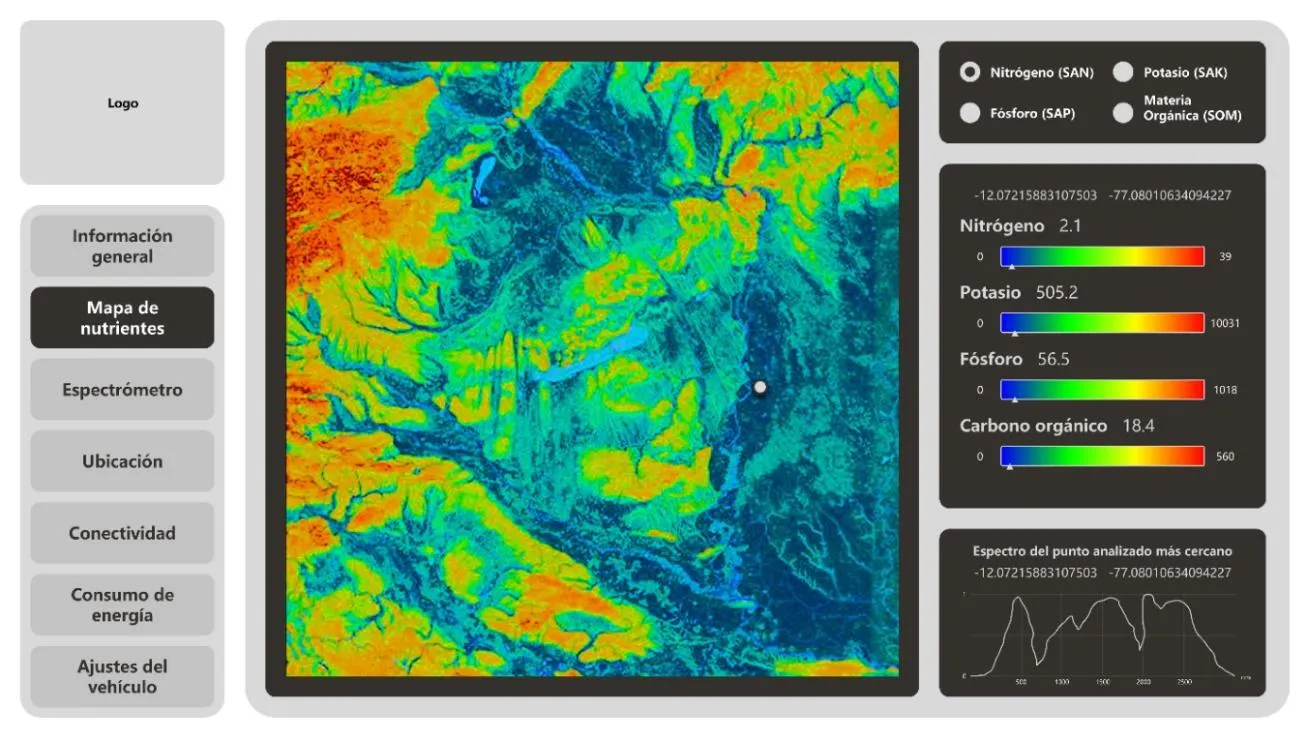
What it is
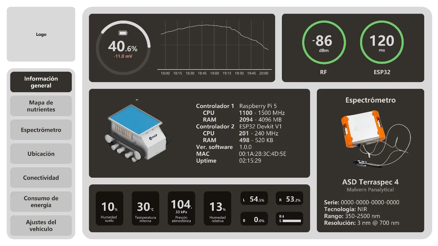
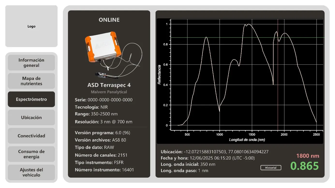
In my thesis I designed the vehicle’s interface in Figma: seven tabs to supervise the robot in the field (overview, nutrient map, spectrometer, location, connectivity, power and settings). Niranden is the real implementation of that interface.
Since the vehicle has not been built, everything feeding the interface is simulated: telemetry, GPS position, spectra and nutrient predictions.
Status
All seven tabs work with locally stored data: overview, nutrient map, spectrometer, location and route, connectivity, power and settings.
- Frontend in React and TypeScript, with ECharts for charts. The field map (boundary, passes, sampling points and vehicle) is a custom SVG on local coordinates, with no satellite tiles.
- Backend in Python with FastAPI and SQLite. A simulator produces position and power telemetry, and synthetic spectra are built from real ASD or CSV readings.
- Prediction models trained with scikit-learn and Cubist on the LUCAS soil dataset, one per variable (pH, organic carbon, carbonates and total nitrogen). They are flagged as research models.
- Every simulated value is labeled as such, and original files are stored with their SHA-256 hash so each reading can be traced back.
Still missing: interpolating the nutrient map (it shows sampling points today), wiring up the real ESP32 and LoRa link, and testing it on a Raspberry Pi 5, the board that would ride on the vehicle.
Demo
For now it runs only locally and behind a login. Once there is a public version with sample data, I will put it here.